
 01 / 01
GARMIN
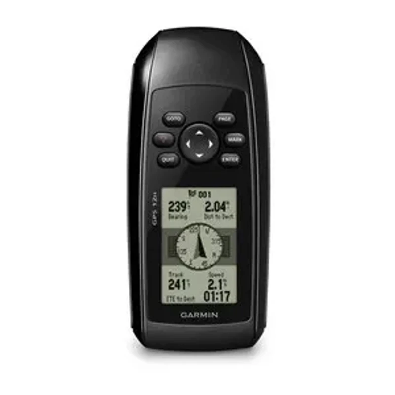
GPS 12H
BUOYANT WATERPROOF HANDHELD GPSRugged, floatable handheld GPS navigator engineered with a buoyant high-impact casing, high-contrast monochrome LCD display, high-sensitivity GPS receiver with SBAS (WAAS/EGNOS), and up to 18 hours of AA battery runtime for marine navigation, field teams, and water operations.
Display2.6-inch diagonal high-contrast 4-level gray FSTN LCD (160 x 240 pixels) with backlight
Buoyancy & IngressFloats in water; IPX7 waterproof rating (submersible to 1 meter for 30 minutes)
Configuration, availability and delivery confirmed with your quotation.
01 / FIELD CAPABILITIES
Built for the task.
- Buoyant floatable design prevents device loss if accidentally dropped into rivers, wetlands, or offshore waters
- High-contrast 2.6-inch monochrome display with adjustable backlighting provides superior sunlight readability in direct glare
- High-sensitivity GPS receiver locks satellites swiftly and tracks position accurately under tree canopies and in challenging terrain
- Dedicated one-touch Man Overboard (MOB) key enables instantaneous location marking and navigation back to emergency coordinates
- Generous 1,000-waypoint storage with customizable identification symbols and 20 reversible navigation routes
- Long-lasting 18-hour battery autonomy on 2 standard AA batteries ensures uninterrupted day-long field and marine surveys
- Rugged high-impact IPX7 waterproof housing withstands harsh weather conditions, mud, and water immersion
02 / TECHNICAL DETAILS
Precision, specified.
- Display
- 2.6-inch diagonal high-contrast 4-level gray FSTN LCD (160 x 240 pixels) with backlight
- Buoyancy & Ingress
- Floats in water; IPX7 waterproof rating (submersible to 1 meter for 30 minutes)
- Receiver Sensitivity
- High-sensitivity GPS receiver with SBAS (WAAS/EGNOS) support for fast signal acquisition
- Housing Material
- High-impact plastic alloy chassis with shock-absorbing non-slip side grips
- Battery Type
- 2 AA batteries (Alkaline, NiMH, or Lithium)
- Battery Autonomy
- Up to 18 hours continuous operation
- Waypoints & Tracks
- 1,000 waypoints with custom symbols / 100 saved tracks (10,000 track log points)
- Routes
- 20 reversible routes (up to 50 waypoints each)
- Marine Functions
- Dedicated Man Overboard (MOB) key, anchor drag alarm, arrival alarm, off-course alarm
- Celestial & Field Data
- Built-in celestial tables: sunrise/sunset times, moon phase, best hunting and fishing times, area calculation
- Connectivity & Interface
- Serial / USB interface (NMEA 0183 output compatible)
- Dimensions (W x H x D)
- 6.9 x 15.7 x 3.0 cm (2.7" x 6.2" x 1.2")
- Weight
- 203 g (7.2 oz) with AA batteries
Key specifications and field-use details. Exact configuration may vary by model or selected variant.
Garmin
Find your position and your next destination with purpose-built handheld navigation.
CONTINUE YOUR EXPLORATION
All products COMPLETE YOUR FIELD KIT.
YOUR NEXT EXPEDITION STARTS HEREBig terrain.
Big terrain.
Bigger possibilities.
Tell us where you're headed.
We'll help you get equipped.