
 01 / 01
GARMIN
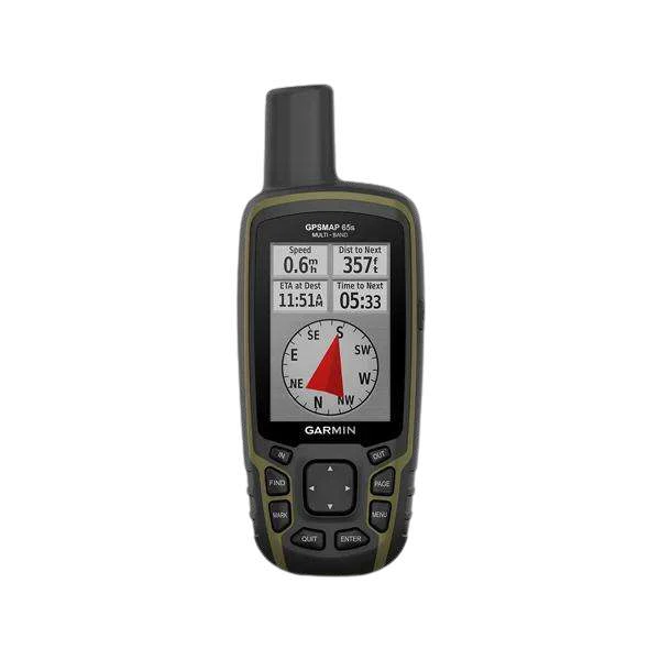
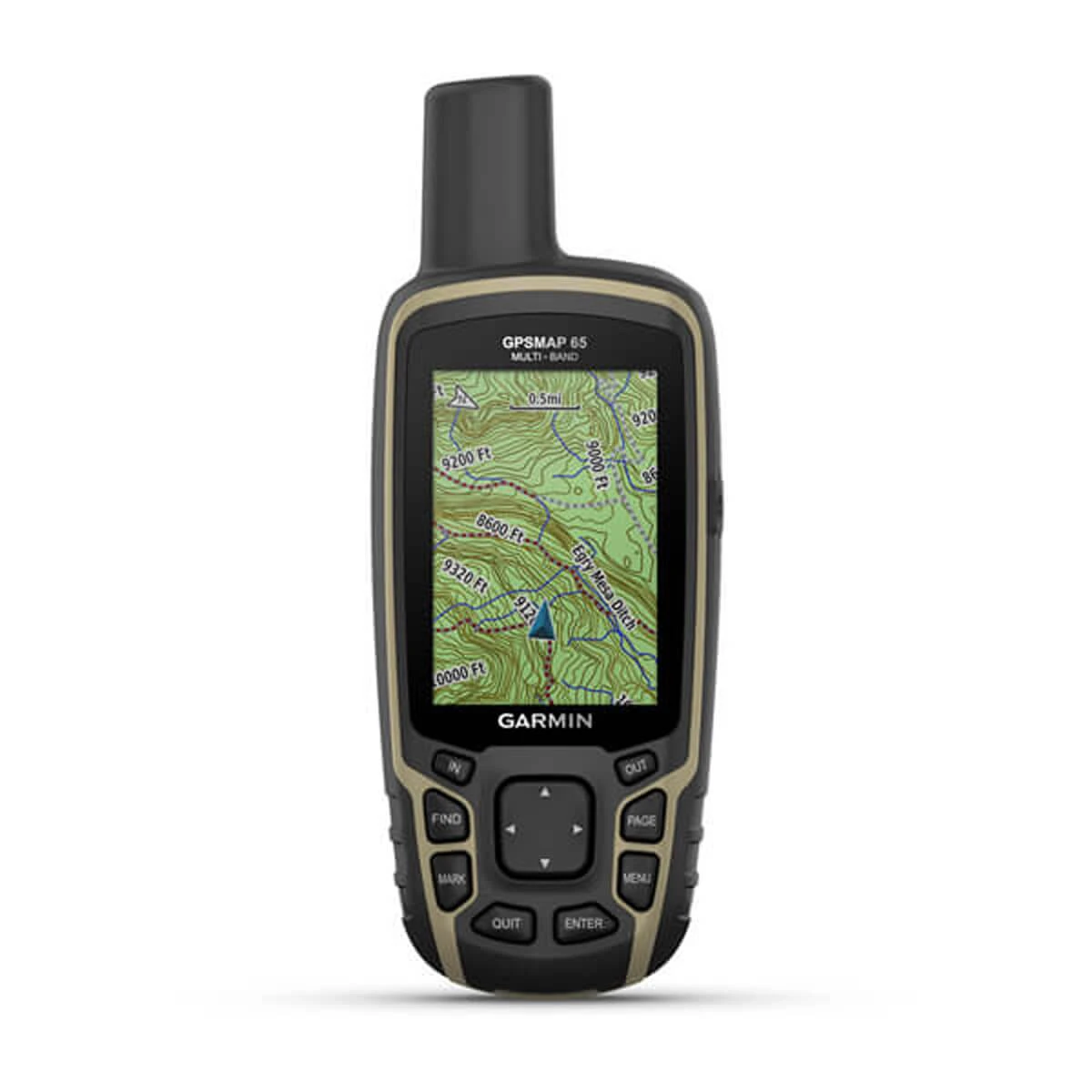
GPSMAP® 65s
MULTI-BAND GPSFind your way in challenging environments with multi-band positioning, expanded satellite support and a sunlight-readable color display.
Display2.6-inch color TFT (160 x 240 pixels), sunlight-readable
PositioningMulti-band GNSS (GPS, GLONASS, Galileo, QZSS, IRNSS)
Configuration, availability and delivery confirmed with your quotation.
01 / FIELD CAPABILITIES
Built for the task.
- Multi-band technology and expanded GNSS support provide optimal accuracy in steep country, urban canyons and dense forests
- Sunlight-readable 2.6-inch color display for easy viewing in all field conditions
- Navigate trails with built-in ABC sensors including 3-axis tilt-compensated electronic compass and barometric altimeter
- Preloaded TopoActive maps provide routable street and off-road networks, waterways, natural features, and points of interest
- Rugged construction with IPX7 water rating for all-weather durability
- Plan, review, and sync waypoints, routes, and tracks using the Garmin Explore app and website
- Up to 16 hours of continuous GPS navigation powered by 2 standard AA batteries
02 / TECHNICAL DETAILS
Precision, specified.
- Display
- 2.6-inch color TFT (160 x 240 pixels), sunlight-readable
- Positioning
- Multi-band GNSS (GPS, GLONASS, Galileo, QZSS, IRNSS)
- Battery life
- Up to 16 hours in GPS mode (2 AA batteries)
- Navigation sensors
- 3-axis tilt-compensated electronic compass & barometric altimeter (ABC)
- Internal memory
- 16 GB internal storage (microSD™ card slot compatible up to 32 GB)
- Water rating
- IPX7 waterproof
- Preloaded maps
- TopoActive maps (routable roads and trails)
- Planning
- Garmin Explore app & website compatibility
Key specifications and field-use details. Exact configuration may vary by model or selected variant.
Garmin
Find your position and your next destination with purpose-built handheld navigation.
CONTINUE YOUR EXPLORATION
All products COMPLETE YOUR FIELD KIT.
YOUR NEXT EXPEDITION STARTS HEREBig terrain.
Big terrain.
Bigger possibilities.
Tell us where you're headed.
We'll help you get equipped.