
 01 / 01
GARMIN
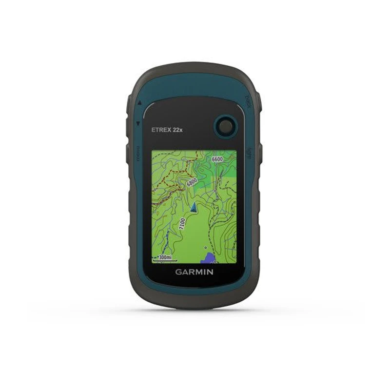
eTrex® 22x
RUGGED HANDHELD GPS NAVIGATORDependable, rugged handheld GPS navigator featuring a sunlight-readable 2.2-inch color display, dual GPS and GLONASS satellite reception, preloaded TopoActive maps, and up to 25 hours of battery life on standard AA batteries for field mapping, forestry, and outdoor navigation.
Display2.2-inch transflective 65K color TFT (240 x 320 pixels), sunlight-readable
Satellite ConstellationsGPS and GLONASS dual-satellite reception
Configuration, availability and delivery confirmed with your quotation.
01 / FIELD CAPABILITIES
Built for the task.
- Sunlight-readable 2.2-inch 65K color display delivers crisp clarity in direct daylight and dense forest canopy
- Dual GPS and GLONASS satellite tracking provides faster signal lock and reliable positioning in steep canyons and heavy cover
- Preloaded TopoActive mapping features routable trails and streets for forestry navigation and terrain reconnaissance
- 8 GB internal storage with microSD card expansion allows loading of specialized topographic, marine, or custom field maps
- Extended 25-hour battery life powered by 2 field-replaceable AA batteries ensures dependable multi-day expedition stamina
- Rugged IPX7 waterproof housing withstands harsh weather, dust, mud, and accidental water immersion
02 / TECHNICAL DETAILS
Precision, specified.
- Display
- 2.2-inch transflective 65K color TFT (240 x 320 pixels), sunlight-readable
- Satellite Constellations
- GPS and GLONASS dual-satellite reception
- Preloaded Maps
- TopoActive maps (routable roads, trails, waterways, landmarks)
- Internal Storage
- 8 GB internal memory
- Expandable Memory
- microSD™ card slot (supports up to 32 GB)
- Battery Type
- 2 AA batteries (NiMH, Lithium, or Alkaline recommended)
- Battery Autonomy
- Up to 25 hours continuous operation in GPS mode
- Water Rating
- IPX7 (waterproof against temporary immersion up to 1 meter for 30 minutes)
- Waypoints & Routes
- 2,000 waypoints / 200 routes / 200 saved tracks (10,000 track log points)
- Interface
- Mini-USB, NMEA 0183 compatible
- Dimensions (W x H x D)
- 5.4 x 10.3 x 3.3 cm (2.1" x 4.0" x 1.3")
- Weight
- 141.7 g (5.0 oz) with batteries
- Field Navigation Tools
- Area calculation, automatic routing, custom POIs, celestial sun and moon tables, paperless geocaching
Key specifications and field-use details. Exact configuration may vary by model or selected variant.
Garmin
Find your position and your next destination with purpose-built handheld navigation.
CONTINUE YOUR EXPLORATION
All products COMPLETE YOUR FIELD KIT.
YOUR NEXT EXPEDITION STARTS HEREBig terrain.
Big terrain.
Bigger possibilities.
Tell us where you're headed.
We'll help you get equipped.